








Gilgit: A Town at the Crossroads of Development and Heritage
By Ahmed Wali Khan
Gilgit is our town, but it is also a living historical landscape. Today, wherever one goes, change is visible. New buildings have appeared, roads have expanded, commercial activity has increased, and the population has grown. What was once a small, semi-urban mountain town has been transformed significantly over the last two decades.
This transformation has many causes. Gilgit has attracted people from different parts of Gilgit-Baltistan as well as from other regions of Pakistan, including communities from places such as Khyber Pakhtunkhwa and Swat. Many came in search of business opportunities, employment, and better access to services. Some have established businesses, while others have settled permanently.
Migration and population growth are not, in themselves, negative developments. Throughout its history, Gilgit has been a meeting place for people, cultures, religions, and civilizations. The town has never been completely static. Its character has evolved with changing political systems, trade routes, communications, technology, and patterns of settlement.
The concern is not that Gilgit is changing. The concern is how it is changing.
A Historic Town Changing Faster Than Its Planning
For hundreds, perhaps thousands, of years, people have passed through this valley. Explorers, traders, pilgrims, soldiers, rulers, and travellers crossed the wider Gilgit region during different historical periods. Gilgit's location made it an important meeting point between the high mountain regions of the Hindu Kush, Karakoram, and western Himalaya.
Modern development has brought many important changes. Governance systems have evolved. Roads and communication infrastructure have expanded. The airport connects Gilgit with other parts of Pakistan. Hospitals, universities, markets, hotels, and businesses have developed. Mobile phones and the internet have transformed communication and access to information.
But development alone does not guarantee quality.
The difficult question is whether Gilgit has developed with a coherent long-term urban vision. In many parts of the town, urban expansion appears to have happened faster than urban planning. Agricultural land, gardens, and open spaces have gradually been converted into residential and commercial areas. Buildings have multiplied, traffic has increased, and the distinction between the historic town and its expanding outskirts has become increasingly difficult to recognize.
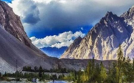
The result is an urban landscape in which concrete is becoming more dominant while greenery and open public spaces are becoming less visible. Gilgit is increasingly at risk of becoming an urban jungle without losing its mountains—a place surrounded by extraordinary natural landscapes but increasingly disconnected from its own gardens, traditional architecture, and historic character.
That should concern us.
What Are We Losing?
A town is not defined only by its buildings. It is defined by its sounds, smells, gardens, trees, streets, traditional houses, public spaces, religious sites, markets, festivals, stories, and memories.
There was a time when parts of Gilgit were recognizable through the sound of running water, the shade of mature trees, children playing in open spaces, traditional houses, orchards, and the movement of people through relatively quiet streets. Today, traffic, construction, and commercial activity increasingly dominate the soundscape.
The transformation is not necessarily irreversible, but it requires recognition. If we continue to develop without asking what should be protected, we may eventually discover that the very things that could have attracted visitors—and given local residents a sense of belonging—have disappeared.
Gilgit has an extraordinary tourism asset, but tourism does not depend only on spectacular mountains. Visitors can see mountains in many parts of the world. What makes Gilgit special is the combination of mountains, history, archaeology, living culture, folklore, rivers, traditional settlements, and the stories of the people who have lived here for generations.
That cultural landscape deserves greater attention.
Key Heritage Sites and Cultural Landmarks
Kargah Buddha and the Memory of an Ancient Gilgit
One of Gilgit's most remarkable heritage sites is the historic rock carving known as the Kargah Buddha, locally associated with the name Yashani. Located approximately 9–10 kilometres from Gilgit city in the Kargah Nallah area, the carving is generally dated by archaeologists to around the seventh century CE. It belongs to a period when Gilgit was an important centre along ancient trans-regional routes and Buddhist religious and intellectual traditions were present across the region.
The importance of Kargah is reinforced by the discovery of the Gilgit Manuscripts in 1931, which provide significant evidence of Buddhist intellectual and religious activity in the region. But Kargah is more than an archaeological monument—it is also part of local memory.
The name Yashani is associated with a local legend about a fierce female demon or monster who was defeated by a holy or spiritual figure and bound to the rock. Some local traditions connect the small holes around the carving with this story, interpreting them as marks associated with the binding of Yashani. Archaeologically, however, this interpretation should remain a legend rather than be presented as established evidence.
This distinction is important. Heritage is not only about what archaeologists can prove; it is also about the stories communities have carried from one generation to another. At Kargah, ancient Buddhist heritage, Silk Road history, archaeology, folklore, and contemporary tourism exist within the same cultural landscape. That is precisely the kind of heritage landscape Gilgit should be protecting.
Konodas Bridge: A Forgotten Gateway
Only a short distance from central Gilgit is another reminder of the town's strategic past—the old suspension bridge at Konodas.
The bridge is associated with the late nineteenth and early twentieth centuries. Historical accounts place its construction between approximately 1895 and 1905, while some records suggest an earlier origin around 1892. Before the Partition of 1947, this crossing was associated with the important communication and trading links connecting the Gilgit Agency with Central Asian territories.
Today, such places can easily disappear from public consciousness because they have been overtaken by modern infrastructure. Yet an old bridge is not merely an old bridge. It tells us how people travelled before modern highways, reflecting engineering, trade, and political geography. It demonstrates that Gilgit was connected to a much wider world long before modern tourism arrived.
The Bireno Suspension Bridge
The Bireno Suspension Bridge at Danyore is another remarkable example of local engineering history. Connecting Danyore with the area of Karakoram International University across the Hunza River, the bridge measures approximately 510 feet in length and eight feet in width.
Construction began in 1957 and was completed in 1960. According to local accounts, the project was led by Ahmed Ali, popularly known as Thakedar Bereno, a self-taught engineer and contractor from Hunza, under a contract of Rs80,000.
Its surroundings add another layer of history:
-
A non-cemented curved tunnel connects the bridge route towards the Karakoram Highway.
-
A shrine associated with Saint Shah Sultan Ali Arif is located above the tunnel.
The bridge was renovated in 2017 due to its cultural and tourism potential. Today it is closed to vehicles but remains open to pedestrians, continuing to serve students and visitors. It was built without modern engineering equipment, standing as a physical reminder of the skills and determination of earlier generations. Modernization should not mean replacing every old structure with something new—sometimes it should mean protecting what has already survived.
China Yadgar: Memory Along the Karakoram Highway
A short distance from Gilgit, at Danyore, stands another important site: the Chinese Cemetery, locally known as China Yadgar.
The cemetery commemorates Chinese engineers and workers who lost their lives during the construction of the Karakoram Highway in the 1960s and 1970s. Records note 88 graves and 140 interments, with tombstones carrying Chinese inscriptions.
The cemetery represents more than the Pakistan-China relationship; it represents the human cost behind one of the world's most remarkable mountain highways. Every road has a story, and the Karakoram Highway is a story of engineering, international cooperation, difficult terrain, and human sacrifice.
The Meeting of the Great Mountain Ranges
Further southeast, at Jaglot, lies one of the region's most dramatic geographical landscapes—the meeting area of the Himalaya, Karakoram, and Hindu Kush.
Located around 40–45 kilometres southeast of Gilgit along the Karakoram Highway, this site also marks the confluence of the Gilgit and Indus rivers and serves as the junction where the road to Skardu branches off. This unique geographical phenomenon should be central to Gilgit's tourism identity. However, destination assets require thoughtful presentation to develop a meaningful visitor experience.
Danyore Rock Inscriptions
The Danyore Rock Inscriptions provide another window into Gilgit's ancient past, featuring Sanskrit inscriptions written in a late Brahmi script associated with the historical rulers of the Patola Shahi dynasty.
Such sites demonstrate that Gilgit is an archaeological landscape rather than simply a mountain destination. The challenge is making this history accessible without turning it into a superficial tourism product. A properly interpreted heritage trail could connect these sites into a continuous story—spanning ancient Buddhist Gilgit, the Silk Road, the colonial period, the Dogra era, the creation of Pakistan, the construction of the Karakoram Highway, and the modern city.
Biddulph House: A Place for Knowledge
Gilgit's heritage is not limited to forts and archaeological remains. The Biddulph House Public Library occupies a historic building dating from 1867 on Khasanna Road. Originally associated with John Biddulph, the first political agent of the Gilgit Agency, it was converted into a public library in 1948.
A library preserves knowledge, making it one of the most vital forms of civic heritage. If Gilgit wants to understand its past and plan its future, places dedicated to books, archives, research, and public learning must be treated as essential community assets.
Agortham and Oral Traditions
Gilgit's heritage lives prominently in its oral traditions, such as the legend of Shri Badat (or Agortham). Local folklore describes him as the last Buddhist ruler of Gilgit, portrayed as a tyrannical ruler with a taste for human flesh.
The story features Azur Jamshed, Princess Miamo, and Agortham's butter heart, which could only be destroyed by extreme heat. Villagers eventually lured him into a pit of burning charcoal to end his reign. Regardless of historical verifiability, its value lies in how generations have remembered and transmitted it. When a city loses its stories, it loses part of its identity.
The Chief Secretary House
The Chief Secretary House represents another layer of regional history. Originating as a British Residency, it was later associated with the Dogra administration before becoming the official residence of the senior civil administration. Structures like this are physical historical documents in architectural form, tracing the different political periods through which Gilgit passed.
Shahi Polo Ground: The Sound of Gilgit
Perhaps no place captures the living character of Gilgit more powerfully than the Shahi Polo Ground. Located in the heart of Gilgit, it has hosted local matches and regional events such as Jashn-e-Baharan for generations.
Polo has deep roots in the region, linked to local rulers and mountain communities long before modern administrative systems were established. The sound of polo—horses, hooves, players, and spectators—is part of the cultural soundscape. Heritage is not silent; it has a sound.
Gohar Aman's Tower
Within the grounds of Army Public School (Hayat Shaheed) stand the remains of Gohar Aman's Tower—a crumbling adobe fragment of a fort built in the 1850s. While a single surviving wall may not look visually imposing, heritage value cannot always be measured by appearance. Sometimes one wall is all that remains of an entire era. Once lost, no amount of modern construction can recreate its authenticity.
The Urban Jungle and the Question of Tomorrow
Gilgit stands near China and is connected to the wider region through the Karakoram Highway, yet its development experience differs sharply from the planned urban environments across the border.
This comparison is not about copying another country, but about asking critical questions regarding our city's direction:
-
Where are our parks and public gardens?
-
Where are our heritage and pedestrian streets?
-
Where can children walk safely?
-
Where can visitors experience traditional Gilgit?
-
Where are the trees, open spaces, and quiet streams?
-
What will Gilgit look like twenty years from now without a long-term urban vision?
Population growth, vehicle traffic, commercial expansion, and tourism demand will continue to increase. Concurrently, climate change, water availability, waste management, traffic congestion, and the loss of agricultural land will present major challenges. If addressed in isolation, solving one development problem may create several others.
Development Should Not Mean Erasing Identity
Gilgit needs modern infrastructure: better roads, reliable public services, hospitals, universities, digital connectivity, safe transport, and economic opportunities.
However, development should not require the destruction of identity. A successful mountain city can be modern and historic at the same time:
-
It can build modern hospitals while preserving its gardens.
-
It can expand universities while restoring its old libraries.
-
It can construct hotels without destroying traditional neighbourhoods.
-
It can build roads without eliminating pedestrian spaces.
-
It can welcome new residents and tourists without erasing its history or commodifying its culture.
A Heritage and Urban Revival Strategy
Gilgit would benefit from a comprehensive Urban and Heritage Revival Plan. Key steps could include:
-
Documentation & Protection: Cataloging remaining historic buildings, gardens, archaeological sites, traditional settlements, bridges, and water channels.
-
Heritage Trails: Developing mapped walking routes with informative interpretation boards at sites like Kargah, Biddulph House, and historic bridges.
-
Urban Guidelines: Requiring new developments to respect the aesthetic character of heritage zones while protecting existing green spaces.
-
Pedestrian Cultural Zones: Creating spaces dedicated to public walkability, local crafts, and community gatherings.
-
Community-Inclusive Planning: Involving local historians, architects, archaeologists, environmentalists, business owners, elders, and youth in urban planning decisions.
Conclusion: Before It Is Too Late
Gilgit possesses something that cannot be built overnight: memory.
Its mountains are extraordinary, but landscape alone does not define a distinctive town. Its strength lies in the interplay of nature and human history—its rivers, orchards, suspension bridges, polo ground, ancient Buddhist carvings, oral traditions, and generations of residents.
Progress should not mean forgetting. The challenge facing Gilgit is not a choice between development and heritage; it is achieving development with heritage, nature, and foresight.
If we fail to protect what remains, we may one day find ourselves describing lost gardens, demolished landmarks, and forgotten streets to future generations. By then, the loss will be irreversible.
Gilgit is changing. The question is whether we will shape that change—or simply watch it happen.
_____
The author is a Development Entrepreneur | Climate Change, Eco-Tourism & Conservation Advocate (Based in Gilgit)
_____
The author is a Development Entrepreneur | Climate Change, Eco-Tourism & Conservation Advocate (Based in Gilgit)
What's Your Reaction?
 Like
0
Like
0
 Dislike
0
Dislike
0
 Love
0
Love
0
 Funny
0
Funny
0
 Angry
0
Angry
0
 Sad
0
Sad
0
 Wow
0
Wow
0

Media Lens
Media Lens leads media in Gilgit-Baltistan, reaching more people than all regional digital outlets and newspapers combined.